Written by: Dr. Christina Buck, Assistant Director of the Department of Water and Resource Conservation, Butte County
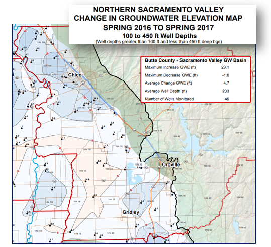
With a historically wet 2017 in the Sacramento River Hydrologic region, there was great anticipation of the results from the spring 2017 groundwater level monitoring conducted by the Department of Water Resources. In Butte County, spring groundwater levels (measured in March) showed an overall average 4.7 foot increase compared to their spring 2016 levels in 46 comparable wells (100-450 ft. depth). Although it may sound moderate, this is a significant increase over the changes we had observed during the past couple of severely dry years. As during the dry years, water levels remained relatively stable, mostly +/- 1 foot of change, in surface water irrigated areas in the county. Groundwater levels have the greatest swings within years and between years in areas that are dependent on groundwater pumping for irrigation and on the east side of the valley. In Butte County, this is mostly north and south of Chico where groundwater irrigated orchards are grown and the City of Chico is served by groundwater. The southern part of the county is characterized largely by surface water irrigated rice, with the exception of the Highway 70 corridor that has orchards served by a mix of groundwater and surface water.
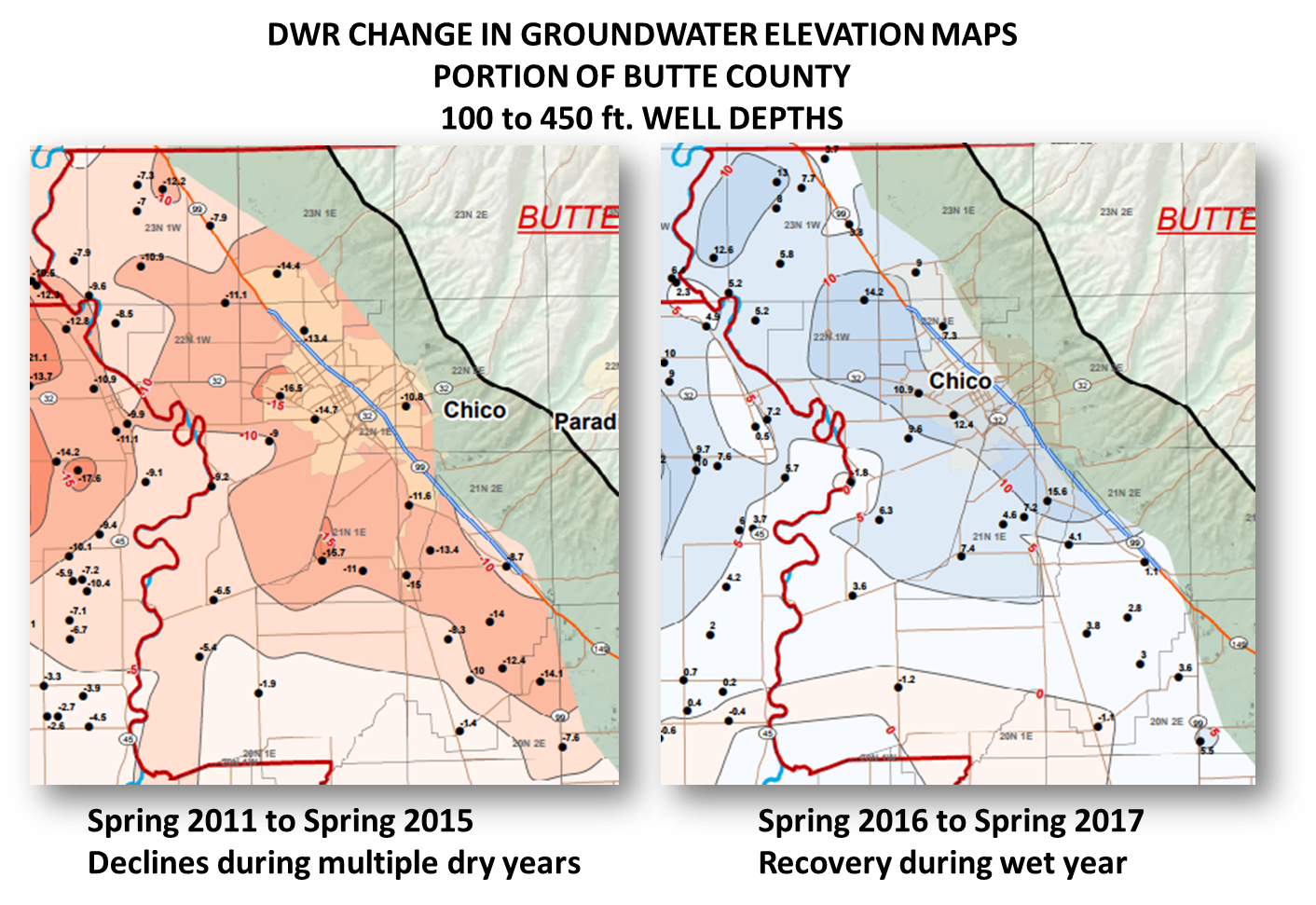
The change maps show that areas with the greatest declines during the dry years (north and south of Chico, 2011-2015), also experienced the greatest increases during the 2017 wet year. Groundwater levels dropped during the recent drought (2011 to 2015) on the order of 5 to 20 feet in the Vina, Chico, Durham and east side areas. In 2017, water levels in these areas increased 5 to 15 feet. Other parts of the county saw more moderate changes both during the dry and wet years, largely due to reliable surface water supplies.
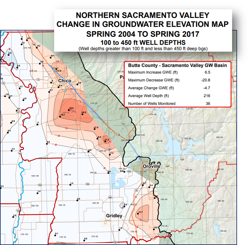
Although the historically wet year largely made up for the most recent severely dry year(s), generally speaking it was not enough to compensate for the cumulative effects of multiple dry years since the mid-2000s. The DWR change map comparing 2004 to 2017 continues to show areas of decline in northern Butte County with the greatest declines south of Chico in the Durham area. Several wells in this area are still down 15 to 20 feet compared to their 2004 levels. It will take multiple wet years, or other direct or indirect (in-lieu) recharge efforts to bring groundwater levels up in this area.
It is important to remember that each monitoring well tells its own story since they vary in depth, well type (irrigation, domestic, dedicated monitoring wells), location, and surrounding conditions, however spring levels overall give a big picture view of basin conditions and how they change throughout the County and over time.
Although areas of decline still exist in the county, the wet year provided much needed recharge to the basin and an opportunity for water levels to recover significantly. We continue to experience great extremes in California hydrology from historically dry to historically wet conditions within just a few years. These big swings in the surface water system generally lead to moderate annual changes in the groundwater system in Butte County, both up and down. Managing our water resources with the reality of these extremes is our challenge and opportunity.